
Justin Bennett
/
Unsplash
Policy changes in healthcare and immigration could leave lasting consequences, researchers say.


-
 Automated License Plate Recognition or ALPR technology has been around for decades. But a new AI-powered version made by a company called Flock Safety is raising major privacy concerns.
 -
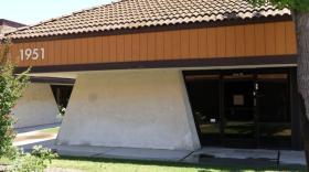
 A company has come out with plans to build so-called “emergency resilience systems” at fairgrounds in California, which may include the Tulare and Kings county fairgrounds. Residents are raising an alarm.
 -
 The report follows a CalMatters investigation highlighting problems with privatized public defense.
 -
 Fresno attorneys say the scandal has shaken trust in the immigration system and the consequences have led to immigrants more subject to be deported.
 -
 West Nile virus, most commonly spread through a bite from an infected mosquito, has so far been confirmed in three San Joaquin Valley residents in 2026.


Research shows older adults who perform music can age slower than those who don’t. Seniors who perform in Fresno County are putting that research to the test.
-
 Israel Cardona Hernandez/KVPRAvenal has become the center of one of the most unusual political disputes unfolding anywhere in California.
 -
 Rosita Ventura-Gomez / The Merced FOCUSChowchilla residents in the upscale gated community of Greenhills Estates may soon see a change, following a year of watching lake levels fall, fish die and algae spread.
 -
 Tim Sheehan / CVJCExpanded tax credits that helped more people pay for health insurance premiums under Covered California expired at the end of December after Congress let them lapse. That meant higher out-of-pocket costs for thousands of Valley residents.
 -
 Mark Schiefelbein / Pool AP via AP/Pool APThe Trump administration says it's deferring over $1 billion in Medicaid payments to Minnesota and California because of suspected fraud and noncompliance.


Brandon Bell
/
Getty Images
Odysseus did not face the parasite Cyclospora in his 10-year journey home. But the word "parasite" originated as a popular character trope in Greek literature.

It’s no secret that California is hard to afford. When it comes to housing, no city or town is left out of the financial squeeze. But the West Side Church of God is doing something no other church in Fresno County has done before: it’s building affordable housing.
-
 Nestled close the Sierra foothills in Tulare County, Porterville began as a ferry crossing on the Tule River.
 -
 Dixon's landscape paintings ranged in styles from impressionism to angular modernism, all while capturing the beauty of the Southwestern landscape.
 -
 The grand hotel has been a Yosemite Valley icon since 1927, and has hosted presidents and royalty.


Central Valley Daily is KVPR's daily news podcast, delivered every weekday morning by 5 a.m.


KVPR Staff


Radio shows
-
 Hosted by Justin Sacher
 -
 Hosted by Frank Dee
 -


